Since it was a clear, virtually windless day, and since I have a flight to make next week-end, I went out to the airport yesterday to make a minor aircraft repair (unclog a plugged pitot tube) and take the bird up for a test flight.
Up and over the mountain ridge to the west, and down into valley on the other side.
Lots of small farms down in these valleys, just a couple hours out of Washington, DC.
At fist glance, some of them look pretty messy, but come the bad times, when things collapse, I'm thinking that these are the folks that'll make it just fine...if they can keep the roaming bands of looters from the DC area at bay.
Hey, there's the Peacemaker Training Center. And it looks like they've got something going on over there. Let's go see.
Oh yeah. They're doing another Tough Mudder race this week-end. I have SO got to get tuned up and do one of these.
Contestats run a 10.2 mile course, with lots of obstacles and cold water thrown in.
If I had a PA system, I'd encourage them by telling them to get off of my obstacle. (warning: video link NSFW.)
I played around for a bit, just seeing what there is to be seen, and cursing whoever designed the latest upgrade to my GPS because the dispay keeps flashing and saying "Caution: Terrain" because I'm within a couple of miles of some high ridges to the west...and the east. Good intent on the designers' part, but annoying on a clear day when I can see them just fine.
I flew back up along Virginia Highway 522 for a bit, and in no time at all, I was approaching the Potomac River. In the river valley was the Potomac Airpark. A steep ridge sit just south of the airport and now the GPS is going nuts with it's terrain warning.
Down with no trouble on their 5000' runway, and back off again, lifting up with Hancock, MD on the right, just across the river.
The Potomac River, with two guys in a fishing boat enjoying their day. Wish I could drop 'em a couple of beers. Heck, I wish I had a couple of beers...for after the flight, of course.
Up north, into Pennsylvania for a bit. It's really pretty up here.
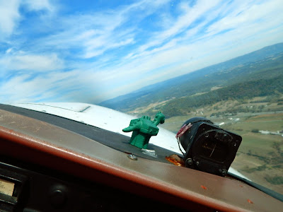
Banking for home. Dashboard dinosaur approves.
More farms.
A train bridge. That water below looks perfect for a float.
Fort Frederick!
Back down over Martinsburg. There's the old railroad roundhouse under restoration.
Some brick kilns at the brickyard just below the right base approach to Runway 26.
80 knots over the fence. Got this one nailed.
Four states visited in 1.6 hours of fun, and the airspeed indicator works perfectly now.


Doncha cap the Pitot tube when not flying?
ReplyDeleteHow does it get clogged?
I'm just curious.
Usually I do keep it covered. I probably picked up a bug while down low in the bug zone.
Deleteah.
DeleteAwesome!
ReplyDeleteI'm jealous........AGAIN!
ReplyDelete;-)
I miss flying. Thanks for the pics!
ReplyDeleteLooks like you had a great flight, and some very nice pics.
ReplyDeleteGreat Pictures
ReplyDeleteThat's a nice way to spend a Sunday. I used to enjoy landing at little bitty fields and having a coke with the FBO. Don't know if people still do that. Our local field isn't even manned after five in the afternoon, or on weekends.
ReplyDeleteYep, pitot systems are 'nice' to have... :-)
ReplyDelete